Lab 4
The main goal of this lab is to excise and develop
my skills in composing as well as implementing query expressions to extract
components of data from a database. This lab is intended to assess my
understanding of attribute and spatial queries.
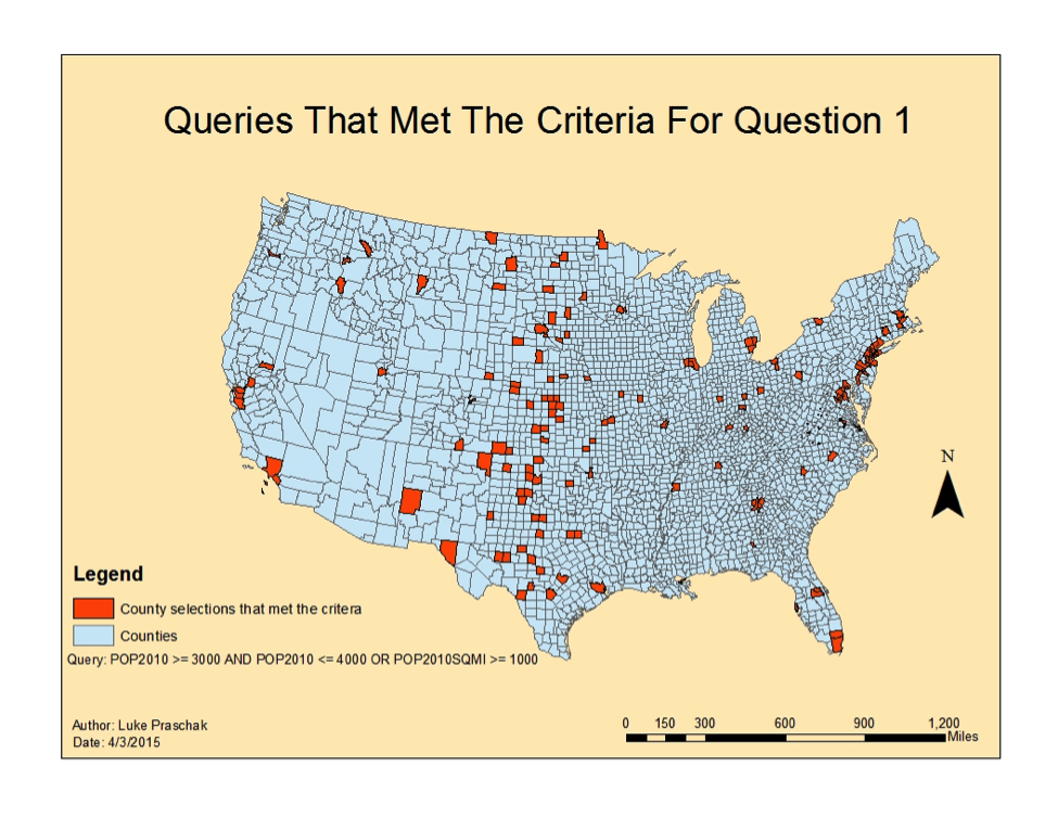
My first task in lab four, part one was to
construct a multiple criteria query for the United States county shapefile. The
query involved retrieving counties with a population between 3,000 and 4,000
people in 2010 and also including all counties in 2010 that had a population
density of at least 1,000 persons per square mile. There was a total of a 194
counties, which included 32 states that met the criteria. Next I wrote a
multiple criteria query that returned records for counties located in
Wisconsin, Texas, Minnesota, New York, and California. The query I developed
would include a greater male population than female and the number of seniors
age 65 and above over 6,500. 46 counties within the five states were returned
from the results and Texas had the highest number of counties at 15. The next
exercise involved modifying the query above by adding all the other seniors age
65 and above in Washington, Maryland, Illinois, Nebraska, District of Columbia,
and Michigan who resided in counties that have more than 30,000 housing units. 128
counties fulfilled the new query.
Part two of lab four was the most challenging and
interesting project, which included a Wisconsin database. My first task is to
develop a query that will return cities in Wisconsin with a 2007 population
between 15,000 and 20,000 people, an area of the city that is at least five
square miles in land area, the female population is greater than males, and
also the cities are within two miles of a lake. Before performing the multiple
criteria query I joined the lakes attribute table to the Wisconsin cities
attribute table because that is the information I would need to help me determine
which cities on the shapefile are located within two miles of a lake. After
using the joining process I was now able to successfully project my data and
get accurate results. There was total of eight cities that met this query’s
criteria. My final task for part two is to create another multiple criteria
query that will calculate the total length of 13 Wisconsin rivers. The distance
of the rivers came to be around 700 miles.
Being able to create multiple criteria queries is
an extremely important skill for retrieving GIS attribute data. Even though it
takes time to learn the SQL language it is unique and fascinating to see how
data can be returned to the user so quickly. This process makes analyzing,
manipulating, and organizing data extremely easy as well as fast.
United States Question 1

United States Question 3


Wisconsin Cities


Wisconsin Rivers


No comments:
Post a Comment